Summary of the Route 66
Corridor Management Plan Tour
• California •
Written in collaboration with: ZachNews • Needles, CA
Photographs by the Newberry Springs Community Alliance
|
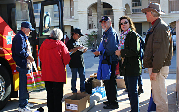
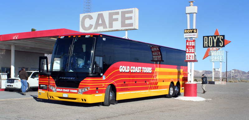
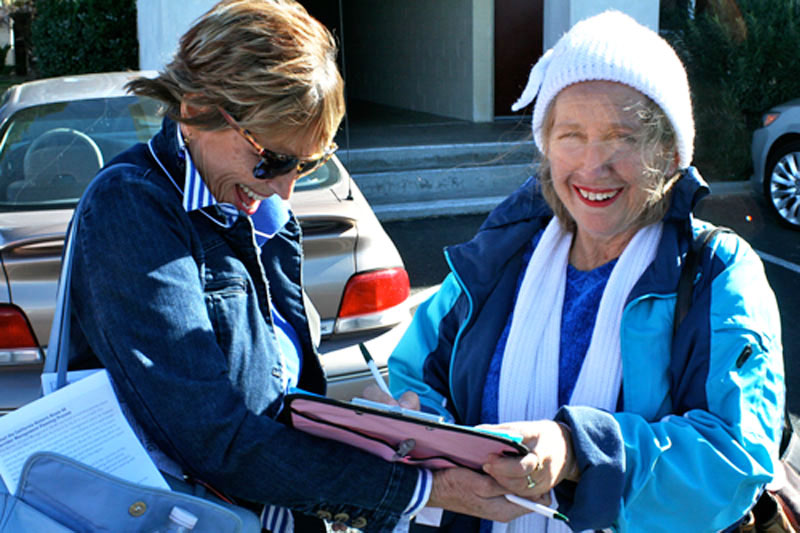 Sheila Beekman-Compton (left) of the California
Historic Route 66 Association, checks-in Margaret Graessle, representing the Newberry Springs
property owners association, prior to boarding the tour bus in Barstow for Needles, California.
Sheila Beekman-Compton (left) of the California
Historic Route 66 Association, checks-in Margaret Graessle, representing the Newberry Springs
property owners association, prior to boarding the tour bus in Barstow for Needles, California.
Corridor Management Plan tries to acquire
a National Scenic Byway designation.
|
Posted: December 21, 2013
What is a National Scenic Byway? A National Scenic Byway is a designation by the Untied States
Federal Highway Administration for a public road having special scenic, historic, recreational,
cultural, archeological, and/or natural qualities that have been recognized as such through
legislation or official designation. It refers not only to the road itself, but also to the corridor
through which it passes.
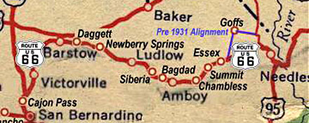
The historic and world famous Route 66 highway runs through 8 states. Four of
those states, Arizona, Illinois, New Mexico, and Oklahoma already have a National Scenic
Byway designation for Route 66; but with all the beauty and stories of California's portion of Route 66,
California has yet to acquire a National Scenic Byway designation for any segment of its route.
Does Route 66 in California qualify for such a designation? Yes, concurrent Resolution
No. 6 passed by the California Assembly and Senate in July 1991 designated California's portion
of former United States Route 66 as "Historic Highway Route 66".
The Route 66 Corridor Management Plan is an effort to collect and package supportive data
meeting the criteria necessary for the federal government's establishment of a National Scenic Byway
designation for the road's portion between Needles and Barstow.
How do we obtain this designation for California? The first step is to complete a Corridor
Management Plan. This is a comprehensive document that identifies the specific byway route,
outlines the special intrinsic qualities along the corridor, and develops a plan on how to market
the byway. The Corridor Management Plan is developed at the grassroots level with
participation from local and county governments, Chamber of Commerces, transportation planning
agencies, tourism bureaus, local businesses, and other Route 66 advocates.
How can we pay for a Corridor Management Plan? Federal funding is available for this
purpose through a competitive grant process. The Bureau of Land Management's California Desert
District requested and was awarded such a grant to create the Corridor Management Plan from the
Department of Transportation for the 153-mile portion of Route 66 starting from Needles.
The California Historic Route 66 Association and the California Preservation Foundation are partners
in this effort with support from the National Park Service Route 66 Corridor Preservation Program
and other groups. The California Historic Route 66 Association is the lead entity.
The firm of Lardner & Klein of Virginia has been selected as the contractor to write the
Corridor Management Plan.
In early 2014, the organizers helping with the Corridor Management Plan will hold at least 2 public
meetings, one in Needles and the other in Barstow. The draft of the Corridor Management Plan
will be made available to the public, and the public will have the opportunity to participate in
the plan by offering stories about the highway, suggestions on how to improve the plan, and
contribute ideas on how this important part of U.S. history can stay alive and managed for
future generations.
More information about National Scenic Byways is at the official National Scenic Byways website
address of: Byways.org where the
the potential exciting benefits of a National Scenic Byways designation can be viewed.
ZachNews photojournalist, Zachary A. Lopez, talked to Jim Klein of Lardner & Klein
about the main goal of this field trip along this portion of Route 66 between Needles and
Barstow. Jim Klein is the prime contractor on this project and is working with the
California Historic Route 66 Association and the Bureau of Land Management.
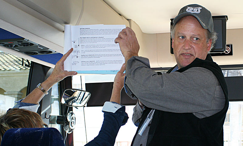 Jim Klein discusses the Corridor Management
Plan onboard the tour bus.
Jim Klein discusses the Corridor Management
Plan onboard the tour bus.
Jim Klein tells ZachNews that the Bureau of Land Management, who manages most of the land along this
route, is an important player and that they are really interested in working with the communities
to increase economic activity. The plan is to find ways that everybody can agree on to
preserve the resources, to tell all those stories that enhances the route for visitors so that
they can better understand and appreciate; and to determine how to best manage the route for
increase heritage base tourism.
Jim Klein also tells ZachNews that we want to figure out how to get the information distributed
ahead of time so that people can know what to look for along Route 66. This can be done
at Gateways, visitor centers along the Interstate, and museums. If people come and learn about
what is here, he believes that they will be eager about taking a trip once they know why they
should drive and experience it.
To familiarize the key people working on the plan, and other stakeholders,
of the current elements of the proposed corridor, a bus tour was organized.
Gathering at Needles
On December 3, 2013, a bus loaded with people helping with the preparation of a Corridor Management Plan
arrived in Needles about 5:00 P.M. where they were greeted by a local group of people
at a welcoming party held at the Juicy's Famous River Café.
 Needles resident, Ruth Musser-Lopez, of the Archaeological
Heritage Association of the Lower Colorado River (River AHA),
speaks before approximately fifty people assembled at Juicy's Famous River Café.
Needles resident, Ruth Musser-Lopez, of the Archaeological
Heritage Association of the Lower Colorado River (River AHA),
speaks before approximately fifty people assembled at Juicy's Famous River Café.
Attending the welcoming event were Needles Mayor Edward T. Paget and his wife Jan, City
Council members Jim Lopez and Linda Kidd, City Manager Rick Daniels, Sue Godnick of the
Needles Chambers of Commerce, Jan Jernigan of the Needles Downtown Business Alliance, and
numerous others.
Following the evening event, the people going on the field trip rested for the night at Needles'
Rio Del Sol Inn in preparation for the following day.
The Tour
The next morning, the field excursion started at 8:30 A.M.
with the bus's first stop at the El Garces Harvey House and Train Depot, which is currently under
renovation to give life back to the importance of Needles' railroad history.
The bus then departed Needles driving along the city's many beautiful Route 66 murals,
as well as the old gas stations that have been restored by volunteers so that the life and the
story of these stations can continue to be a part of Route 66.
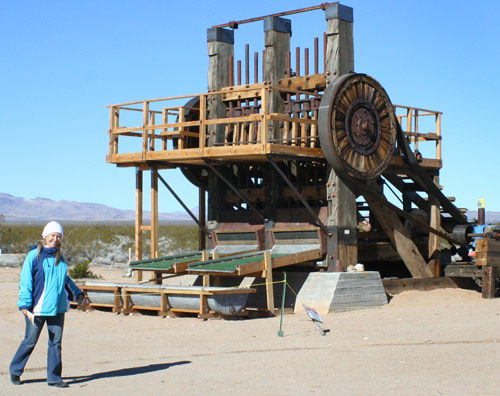
 Goffs' school house interior.
The expedition headed 30 miles to the old railroad town of Goffs where the bus stopped at the
Goffs School House that was originally built in 1914.
 Historic pictures, artifacts, clothing, and tools used back in the early Twentieth
Century are on display there, including a wood fire stove that was still working and keeping the room
warm for visitors.
Historic pictures, artifacts, clothing, and tools used back in the early Twentieth
Century are on display there, including a wood fire stove that was still working and keeping the room
warm for visitors.
Outside the Goffs School House, historic mining, railroad and other interesting items are
on display in a beautiful desert backdrop setting.
The tour then traveled 14 miles and slowed while passing General Patton's Camp Essex Army
Airfield that the desert has largely reclaimed.
In another 3 miles was Essex itself where remanants of
old gas stations still sit alongside the highway remembering the times when people traveling
by stopped, rested and refueled their vehicles and themselves before heading back onto the
rough, narrow roadway. Essex was quite a roadside center in its heyday, with gas stations,
markets, and cafés. Essex was also known for the availability of free water that
carried a price tag elsewhere. About 4 dozen structures lie abandoned nearby with only
a Caltrans yard, schoolhouse, and a one-man Post Office showing activity.
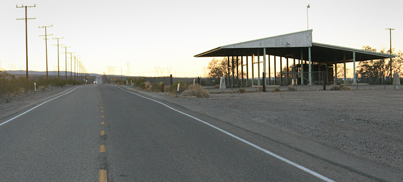
The bus then made a stop 15 miles from Essex at a rest stop with a roadside plaque on the south
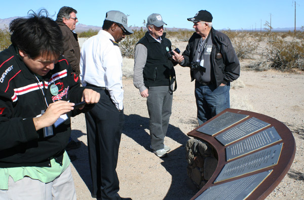 side of the highway. Here, while enjoying the scenic vistas, the people on the tour had
boxed Subway sandwiches for lunch that they had preordered. This rest area is one of the
first three roadway turnout rest areas that were built in California; all three of which are
located on Route 66.
side of the highway. Here, while enjoying the scenic vistas, the people on the tour had
boxed Subway sandwiches for lunch that they had preordered. This rest area is one of the
first three roadway turnout rest areas that were built in California; all three of which are
located on Route 66.
Traveling on for 2.5 miles, the tour transversed Cadiz Summit and scooted 3 miles into the town of
Chambless, where the bus first passed an old building where ticketed speeders
would be forced to drive to (often great distances backtracking their progress), to pay their
ticket fines. It had the only judge in the region.
The original flagpole still stands that flew a flag indicating when the judge was in.
When he wasn't, a ticketed traveler's situation became worse.
The tour quickly passed through Chambless, which was originally called Chambless Station.
Chambless was the location of the famed Roadrunner's Retreat restaurant, a mile-plus west of the town, known
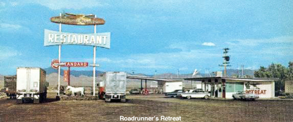 for its tall, landmark Roadrunner's Retreat sign. The restaurant closed in 1995.
The ghosts of the closed Chambless storefronts silently sit in testimoney to the times when tired,
dusty travelers stopped by this waypoint for provisions and shade before heading back to the
discomfort and the many risks of desert travel.
for its tall, landmark Roadrunner's Retreat sign. The restaurant closed in 1995.
The ghosts of the closed Chambless storefronts silently sit in testimoney to the times when tired,
dusty travelers stopped by this waypoint for provisions and shade before heading back to the
discomfort and the many risks of desert travel.
The study trip then headed 11 miles to Amboy where the bus first passed by an old fallen tree,
 known as the "Shoe Tree," that reportedly collapsed in 2010 from the weight of too many
shoes on the tree.
known as the "Shoe Tree," that reportedly collapsed in 2010 from the weight of too many
shoes on the tree.
The bus pulled-up and stopped at the Roy's Café and the tour participants got to go inside
an old church that at one time was adjacent the main highway until the highway was realigned.
Amboy was first settled in 1858 and the town established in 1883. Amboy was bypassed with the
opening of Interstate-40 in 1973.
Albert Okura, the owner of the Juan Pollo Restaurants, purchased the entire town of Amboy
in 2005 for $425,000. Albert Okura talked about the church, the town, and what he and others
have been working on to keep the history of Amboy alive. The Amboy school, which is adjacent
to the Roy's Café, reportedly closed in 1999.
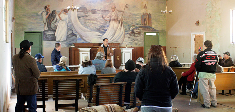 Albert Okura (center) talks to a few of the
tour participants inside the Amboy church.
Albert Okura (center) talks to a few of the
tour participants inside the Amboy church.
The tour departed Amboy heading west and in 3 miles passed the Amboy Crater
and Lava Field which is a 6,000-year-old extinct North American cinder cone-type volcano that
rises above a 70 square kilometer lava deposit that can be seen for miles from Route 66.
 An early portion of Bagdad, California.
Another five miles and there was Bagdad, with nothing to show.
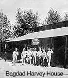 Bagdad was impressive in its
prime. It sported a Fred Harvey House on the north side of the tracks that was basically a
lunchroom serving Santa Fe employees. On the south side,
Route 66 travelers were served by thriving hotels, gas stations, merchantile stores, and churches.
Bagdad served as a shipping depot for early day mining and ranching. The original Bagdad
Café was large and co-functioned as the region's social center. The café reportedly
closed in 1968, and with the opening of Interstate-40 a few years later, the town's population
rapidly vanished. Whatever structures were left standing in 1991 were razed and cleared for
a temporary gas pipeline storage yard.
Bagdad was impressive in its
prime. It sported a Fred Harvey House on the north side of the tracks that was basically a
lunchroom serving Santa Fe employees. On the south side,
Route 66 travelers were served by thriving hotels, gas stations, merchantile stores, and churches.
Bagdad served as a shipping depot for early day mining and ranching. The original Bagdad
Café was large and co-functioned as the region's social center. The café reportedly
closed in 1968, and with the opening of Interstate-40 a few years later, the town's population
rapidly vanished. Whatever structures were left standing in 1991 were razed and cleared for
a temporary gas pipeline storage yard.
Seven miles westward are the few visible remains of the town of
Siberia were only a few partial walls still stand.
This was another roadway stop that was developed adjacent a railroad water tower that also featured
a rail siding. The bus drove along a dirt road to where an earlier alignment of Route 66 once
ran through the small whistle-stop until a realignment was established slightly to the south where
the route remains today. Siberia closed its doors soon after the opening of Interstate-40.
Now, the few stone walls lie in testimony as to what was once a gas station sitting on a sun baked
highway just south of the iron tracks. Here the tour drove over a rare original patch of
Route 66 asphalt that has not been resurfaced.
The excursion then targeted Ludlow 13 miles away where the bus drove upon what was once the
community's main street until a realignment of the highway bypassed the town's historic buildings
that had earlier served travelers and the mining railroad hub.
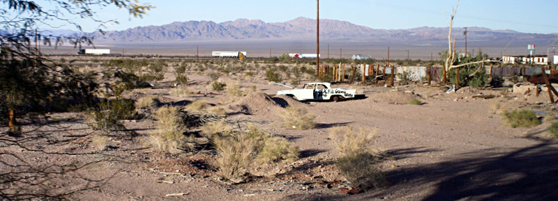 Traveling on Ludlow's abandoned main street,
an abandoned vehicle can be seen straddling the abandoned railbed of the abandoned Tonopah &
Tidewater Railroad. Trucks on Interstate-40 can be seen in the background.
Traveling on Ludlow's abandoned main street,
an abandoned vehicle can be seen straddling the abandoned railbed of the abandoned Tonopah &
Tidewater Railroad. Trucks on Interstate-40 can be seen in the background.
The bus stopped on what appeared to be a dirt path but the tour group was informed that it
was really an old abandoned railbed for the famed Tonopah & Tidewater Railroad that
ran north through remote areas of the Mojave Desert from Ludlow, off the Santa Fe Railway
(known now as the Burlington Northern Santa Fe Railway), up to the Death Valley area
terminating at the mining town of Tonopah.
 This agricultural inspection site
lies on a latest Route 66 alignment leading into Daggett. Despite some belief that this
was the inspection station of the Grapes of Wrath fame, it is not. This station was built
in the 1950's. The earlier inspection site is now a vacant lot just west of the northwest
corner of National Trails Highway and "A" Street in Daggett.
This agricultural inspection site
lies on a latest Route 66 alignment leading into Daggett. Despite some belief that this
was the inspection station of the Grapes of Wrath fame, it is not. This station was built
in the 1950's. The earlier inspection site is now a vacant lot just west of the northwest
corner of National Trails Highway and "A" Street in Daggett.
As the bus traveled closer to Barstow, the field trip headed into Daggett where the bus passed the
old California State Agricultural Inspection Station and stopped at the famed Alf blacksmith shop.
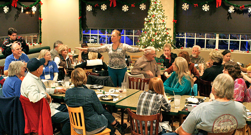
The field trip continued on into Barstow where the bus pulled into the Quality Inn for lodging and
where the participants ate from a buffet at the Los Domingos restaurant followed by a presentation
about the Corridor Management Plan and the National Scenic Byway designation.
The following morning, December 5, 2013, the tour continued aboard the bus at 8:30 A.M. for
the last day of the trip along Route 66 in Barstow.
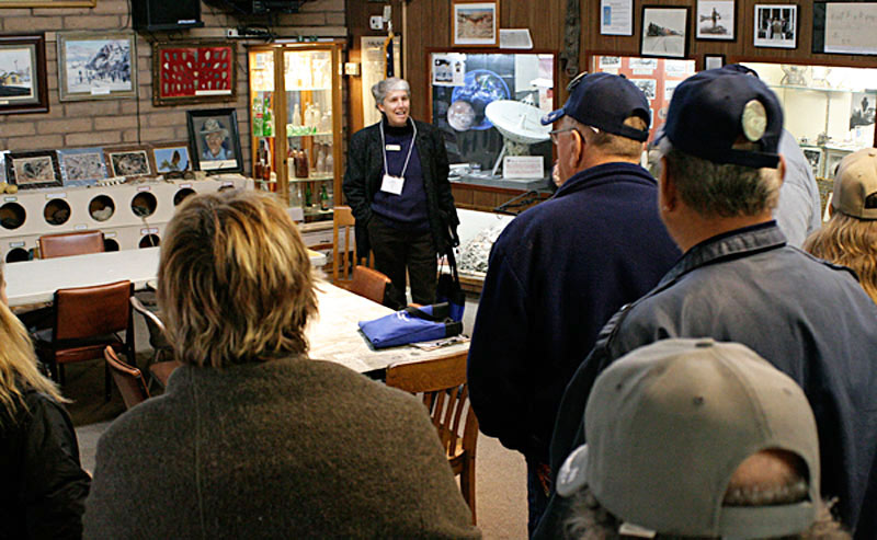 The coterie of kindred spirits headed to the Mojave River Valley Museum where the group was
introduced to the museum. The museum is dedicated to the preservation and promotion of the
scientific, historical, and the cultural heritage of both Barstow and the Mojave River Valley.
The museum contains many historic pictures, artifacts, and stories about the community and the
valley.
The coterie of kindred spirits headed to the Mojave River Valley Museum where the group was
introduced to the museum. The museum is dedicated to the preservation and promotion of the
scientific, historical, and the cultural heritage of both Barstow and the Mojave River Valley.
The museum contains many historic pictures, artifacts, and stories about the community and the
valley.
Outside the museum and facing at the intersection of Barstow Road and Virginia Way, an old Atchison,
Topeka & Santa Fe Railway passenger Coach 932D and a log built cabin with the name,
"Gaddis Blacksmith Shop," and some old mining cars are on display. Across the
street from the museum is an old Atchison, Topeka & Santa Fe Railway red caboose next to a
military tank on display.
The field trip then headed into Old Town Barstow where murals and some
historic buildings, shops, and motels line Route 66.
The tour turned north
 onto First Street and passed over the BNSF railroad yard on
an iron trestle bridge that offers a great aerial view of the Barstow Harvey House
below, that was the next destination.
onto First Street and passed over the BNSF railroad yard on
an iron trestle bridge that offers a great aerial view of the Barstow Harvey House
below, that was the next destination.
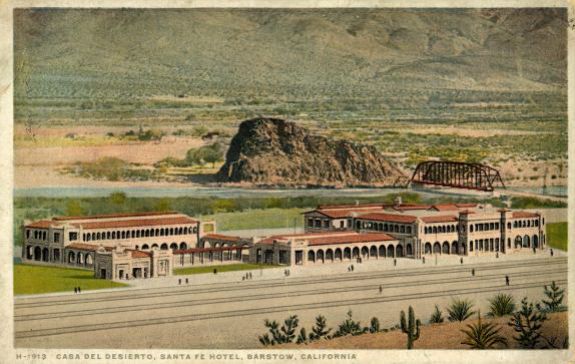
Barstow's Main Street use to run adjacent
and parallel the rail tracks pictured. Structures to the left, in the postcard, have
been removed long ago. Main Street was about where the tracks in the foreground
are pictured.
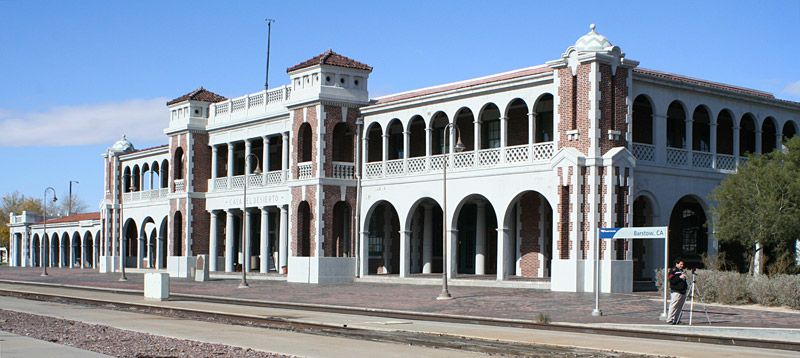 The Barstow Fred Harvey House also known
by its earlier name, Casa del Desierto, was built as a train station and hotel. The original
structure was built in 1885 and burned in 1908. The current replacement structure built by
the Atchison, Topeka & Santa Fe Railway is now used as an unmanned train station and offices
for the city, the Barstow Chamber of Commerce, a train museum, and a Route 66 museum.
The Barstow Fred Harvey House also known
by its earlier name, Casa del Desierto, was built as a train station and hotel. The original
structure was built in 1885 and burned in 1908. The current replacement structure built by
the Atchison, Topeka & Santa Fe Railway is now used as an unmanned train station and offices
for the city, the Barstow Chamber of Commerce, a train museum, and a Route 66 museum.
 The main entrance to the Barstow Harvey House.
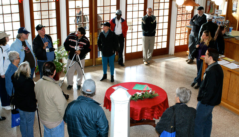
The stop at the Harvey House included an informal tour where the participants learned about the
history of the property, the Fred Harvey House operations, the famed Harvey Girls, and stories
about the old hotel being haunted.
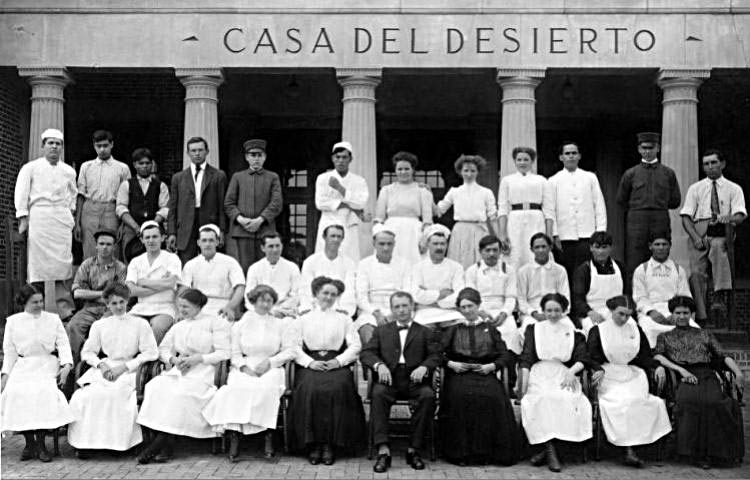 Early staff group photo at Barstow's Harvey House.
The tour visited the Route 66 "Mother Road" Museum where classic vehicles, signs,
items from old gas stations, music, and much more about the highway were enjoyed.
A planned visit to the Western American Railroad Museum didn't happen, and that was the only glitch
in the tour's program, when the museum's key keeper had a last minute family medical emergency and
couldn't arrive as planned. The museum does have a large number of outdoor rail cars and
locomotives on display.
Before departing the Harvey House, the participants gathered together and discussed what they
had learned and what is next in the process in getting the Corridor Management Plan developed
to acquire the desired National Scenic Byway designation.
The tour group got onto the bus and headed back into Old Town Barstow where the bus toured
around the many beautifully displayed murals in the old downtown Main Street area.
The bus returned to the Quality Inn where the 3-day trip along Route 66 officially came to an end.
 A Special Thank You!
The people on the field trip learned a massive amount of information about the segment of Route 66
that is the subject of the proposed corridor plan. This news blog only skims the surface of
the information acquired of the towns and the open spaces visited.
The trip's participants learned of the struggles and challenges of living on Mainstreet U.S.A.
with whole towns having to relocate to changing road alignments or close.
As traffic volume increased and vehicles became larger and faster, realignments for safety
became a part of the road's evolution process. Like a long desert Sidewinder, the roadway
had to repeatedly shed and abandon its skin, growing a new one in order to continue its role
in life.
Only a few skeletons of Route 66's earlier buildings remain;
the desert is quick to reclaim the natural elements. Each of the dissolving buildings,
their foundations, silently hold the stories of the hope and aspirations of many families.
Preserving these buildings is preserving the roots of the people who built, worked, and died on
Route 66. More than the asphalt that was later applied, these people were the fiber of the
Mother Road that depended upon the human presence to support the flow of travelers and their dreams.
Dreams that went on to build America.
The participants on the study tour talked to people who are working hard, with little
resources, to preserve the history and the stories of the human toil along the road.
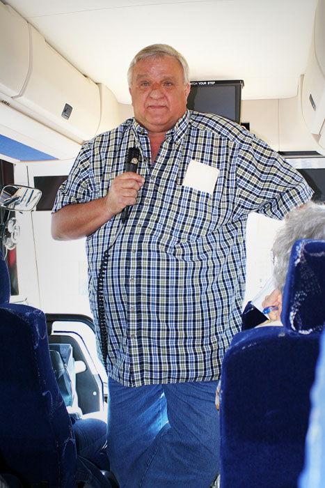
What brought the history of Route 66 to life during this tour, and what
made the tour remarkably fulfilling, was the tour guide for the Needles to Barstow segment,
Mr. Roger Hatheway (pictured), a County of San Bernardiino historian, and an owner of
Hatheway & Associates,
who spoke almost non-stop the entire travel time between Needles and Barstow, pointing-out without
notes the many alignments of the roadbed, when they existed, and many other details that allowed
the travelers a mosaic of experiences.
Mr. Hatheway brought the road and it's towns to life with stories of the
road's stakeholders. The tour's participants thank him for being such a valuable asset of
the CMP discovery trek. Thanks also to the California Historic Route 66 Association for
organizing the detailed trip; and the Bureau of Land Management for acquiring the necessary grant.
The Newberry Springs Community Alliance is the local representive for
the Daggett and Newberry Springs areas for the coordination of the Corridor Management Plan.
For information or to assist, e-mail: NewberrySprings (at) hotmail.com
⊕ Photographs above have been reduced in definition for
faster browser downloading. ⊕
Click here to read, "Like,"
comment, or share on:

|
Follow us on Twitter and
be notified of new stories:

|
• • •
Home page: http://NewberrySpringsInfo.com